
Country United States FIPS code 39-42476 Elevation 309 m Zip code 45135 Local time Tuesday 6:18 PM | Time zone Eastern (EST) (UTC-5) GNIS feature ID 1064980 Area 3.03 km² Population 1,307 (2013) Area code 937 | |
 | ||
Weather -4°C, Wind N at 26 km/h, 62% Humidity | ||
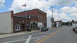
Leesburg is a village in Highland County, Ohio, United States. The population was 1,314 at the 2010 census.
Contents
Map of Leesburg, OH 45135, USA
Leesburg was laid out in 1802, and named after Leesburg, Virginia.
Geography
Leesburg is located at 39°20′47″N 83°33′11″W (39.346333, -83.553045).
According to the United States Census Bureau, the village has a total area of 1.17 square miles (3.03 km2), all land.
2010 census
As of the census of 2010, there were 1,314 people, 513 households, and 344 families residing in the village. The population density was 1,123.1 inhabitants per square mile (433.6/km2). There were 579 housing units at an average density of 494.9 per square mile (191.1/km2). The racial makeup of the village was 97.6% White, 0.2% African American, 0.5% Native American, 0.1% Asian, and 1.6% from two or more races. Hispanic or Latino of any race were 0.7% of the population.
There were 513 households of which 38.8% had children under the age of 18 living with them, 43.9% were married couples living together, 15.2% had a female householder with no husband present, 8.0% had a male householder with no wife present, and 32.9% were non-families. 26.3% of all households were made up of individuals and 12.4% had someone living alone who was 65 years of age or older. The average household size was 2.56 and the average family size was 3.06.
The median age in the village was 33.8 years. 28.4% of residents were under the age of 18; 8.5% were between the ages of 18 and 24; 28.3% were from 25 to 44; 21.9% were from 45 to 64; and 12.9% were 65 years of age or older. The gender makeup of the village was 47.4% male and 52.6% female.
2000 census
As of the census of 2000, there were 1,253 people, 501 households, and 344 families residing in the village. The population density was 1,560.0 people per square mile (604.7/km²). There were 538 housing units at an average density of 669.8 per square mile (259.7/km²). The racial makeup of the village was 98.48% White, 0.64% African American, 0.24% Native American, 0.08% Asian, 0.08% from other races, and 0.48% from two or more races. Hispanic or Latino of any race were 0.16% of the population.
There were 501 households out of which 37.9% had children under the age of 18 living with them, 48.1% were married couples living together, 14.8% had a female householder with no husband present, and 31.3% were non-families. 26.3% of all households were made up of individuals and 8.8% had someone living alone who was 65 years of age or older. The average household size was 2.50 and the average family size was 3.00.
In the village, the population was spread out with 28.1% under the age of 18, 11.7% from 18 to 24, 30.0% from 25 to 44, 18.8% from 45 to 64, and 11.4% who were 65 years of age or older. The median age was 31 years. For every 100 females there were 97.3 males. For every 100 females age 18 and over, there were 91.3 males.
The median income for a household in the village was $34,653, and the median income for a family was $45,893. Males had a median income of $30,865 versus $22,112 for females. The per capita income for the village was $16,531. About 4.7% of families and 6.3% of the population were below the poverty line, including 4.7% of those under age 18 and 13.4% of those age 65 or over.