
Sovereign state United Kingdom Postcode district ME17 Local time Tuesday 9:48 PM | ||
 | ||
Population 2,500 (2005)790 (2011. Including Ashbank and Bexon) Weather 11°C, Wind SW at 6 km/h, 82% Humidity | ||
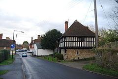
Leeds is a village and civil parish in the Maidstone District of Kent, England. The parish is located to the east of Maidstone.
Map of Leeds, UK
The village of Leeds is five miles (8 km) from the county town. It appeared in the Domesday Book of 1086 called Esledes - an old English word meaning slope or hillside. It is so called because the village is on the hillside above the River Len, a tributary of the River Medway. An alternative explanation for the name is that it derived its name from Ledian, who built the first wooden fortress here in 978. It also has a primary school, Leeds and Broomfield C of E Primary.
St Nicholas's Church has the second largest Norman tower in England. Leeds Priory was dissolved in 1539. To the east of the village is Leeds Castle. The church and the castle are Grade I listed buildings and the site of the priory is a scheduled monument.
To the west and between Otham and Leeds the area of Caring is located. Caring has a number of modern farmhouses, in the style of an Oast house. Another attraction is the old Vineyard, a free tourist feature.