
Country United States Time zone CST (UTC-6) Population 93,184 (2013) | Elevation 1,037 ft (316 m) Local time Tuesday 3:55 PM | |
 | ||
ZIP codes 64015, 64063, 64064, 64081, 64082, 64083, 64086, 64134, 64139, 64149 Weather 0°C, Wind N at 11 km/h, 61% Humidity Points of interest Lea McKeighan Park, Lowenstein Park, The Exit Room, Miller J Fields Park, Happy Tails Park | ||
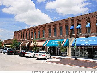
Lee's Summit is a city located within the counties of Jackson (primarily) and Cass in the U.S. state of Missouri. As of the 2010 census its population was about 91,364, making it the sixth-largest city in both the state and in the Kansas City Metropolitan Area. In 2006, CNN/Money and Money magazine ranked Lee's Summit 44th on its list of the "100 Best Cities to Live in the United States." That ranking improved to 27th on the 2010 list.
Contents
- Map of Lees Summit MO USA
- Origin of name
- History
- Geography
- Demographics
- 2010 census
- 2000 census
- Top employers
- Education
- Climate
- Transportation
- Major roads
- Other
- Media
- Appearances in film
- Notable people
- References
Map of Lee's Summit, MO, USA
Origin of name
Founded as the "Town of Strother", by William B. Howard for his wife, Maria D. Strother (daughter of William D. Strother formerly of Bardstown, Kentucky). Howard came to Jackson County in 1842 from Kentucky, married Maria in 1844, and by 1850 he and Maria had 833 acres (3.37 km2) and a homestead five miles (8 km) north of town. He was arrested for being a Confederate in October 1862, near the beginning of the Civil War, and after being paroled he took his family back to Kentucky for the duration of the war. After the war ended he returned and, knowing that the Missouri Pacific Railroad was surveying a route in the area, platted the town with 70 acres (280,000 m2) in the fall of 1865 as the town of Strother.
In 1865 the town of Strother changed its name for early settler Dr. Pleasant John Graves Lea, who moved to Jackson County in 1849, from Bradley County, Tennessee. Lea was listed as the postmaster of Big Cedar in the 1855 United States Official Postal Guide. Dr. Lea was killed in August 1862 by Kansas Jayhawkers (or Redlegs).
When the surveyors for the Missouri Pacific Railroad came through, the local people and the railroad wanted to name the town in Dr. Lea's honor. He had a farm on the highest point and near the path of the tracks, and his murder had taken place near the site of the proposed depot. So they chose the name of "Lea's Summit", the "summit" portion to reflect its relatively highest elevation on the Missouri Pacific Railroad between St. Louis and Kansas City. But they misspelled the name "Lees Summit" (with two "e's"; "Lee" instead of "Lea"; and leaving out the apostrophe) on a boxcar that was serving as a station and donated by the Missouri Pacific, then a sign next to the tracks, and finally in the printed time schedule for the railroad. Also the name was misspelled on the stone culvert near the station, on the side of the Missouri Pacific depot, but on the other side it was spelled correctly, accordingly the railroad used this spelling, as did travelers.
Others, those with Southern sympathies, claim that the town was named after famed Civil War General Robert E. Lee after Southerners began moving north into Missouri after the war. Attributed to a misquote in the Louisville Journal, January 3, 1866.
Since the name was already being circulated and published with two "e's", the town petitioned the state legislature and incorporated its name in 1868 as: "Town of Lee's Summit".
History
Growth of the town can be studied through historic Sanborn Maps, which document building types and uses in the city during the late nineteenth and early twentieth centuries.
In 1912, R.A. Long, the owner of a lumber company, began building his estate, named Longview Farm, on the western edge of the city and into part of Kansas City. When complete, it had a mansion, five barns and 42 buildings in the 1,700 acres (6.9 km2). (Moses Metheny, the great-grandfather of jazz legend Pat Metheny, was a co-founder.) The farm also had a church, Longview Chapel Christian Church, which was completed in 1915. It soon became internationally known as a showplace farm. Today, one of the horse barns is home to Longview Farm Elementary, and the site of Longview Community College. The church and mansion are on the National Register of Historic Places. Other parts of the farm have been turned into Longview Lake, Longview Community College, and a development called New Longview.
Lee's Summit is also home to:
Geography
Lee's Summit is located at 38°55′21″N 94°22′27″W (38.922607, -94.374127). According to the United States Census Bureau, the city has a total area of 65.39 square miles (169.36 km2), of which, 63.35 square miles (164.08 km2) is land and 2.04 square miles (5.28 km2) is water.
Demographics
According to a 2007 estimate, the median income for a household in the city was $71,821, and the median income for a family was $82,737.
2010 census
As of the census of 2010, there were 91,364 people, 34,429 households, and 25,126 families residing in the city. The population density was 1,442.2 inhabitants per square mile (556.8/km2). There were 36,679 housing units at an average density of 579.0 per square mile (223.6/km2). The racial makeup of the city was 86.1% White, 8.4% African American, 0.3% Native American, 1.7% Asian, 0.1% Pacific Islander, 1.1% from other races, and 2.4% from two or more races. Hispanic or Latino of any race were 3.9% of the population.
There were 34,429 households of which 39.5% had children under the age of 18 living with them, 58.3% were married couples living together, 10.9% had a female householder with no husband present, 3.8% had a male householder with no wife present, and 27.0% were non-families. 22.8% of all households were made up of individuals and 8.9% had someone living alone who was 65 years of age or older. The average household size was 2.63 and the average family size was 3.11.
The median age in the city was 37.2 years. 28% of residents were under the age of 18; 7.1% were between the ages of 18 and 24; 27% were from 25 to 44; 26.6% were from 45 to 64; and 11.5% were 65 years of age or older. The gender makeup of the city was 47.9% male and 52.1% female.
2000 census
As of the census of 2000, there were 70,700 people, 26,417 households, and 19,495 families residing in the city. The population density was 1,188.0 people per square mile (458.7/km²). There were 27,311 housing units at an average density of 458.9 per square mile (177.2/km²). The racial makeup of the city was 93.17% White, 3.47% African American, 0.36% Native American, 0.99% Asian, 0.06% Pacific Islander, 0.52% from other races, and 1.42% from two or more races. Hispanic or Latino of any race were 1.97% of the population.
There were 26,417 households out of which 40.8% had children under the age of 18 living with them, 62.1% were married couples living together, 8.9% had a female householder with no husband present, and 26.2% were non-families. 22.0% of all households were made up of individuals and 9.2% had someone living alone who was 65 years of age or older. The average household size was 2.65 and the average family size was 3.12.
In the city, the population was spread out with 29.2% under the age of 18, 6.6% from 18 to 24, 33.1% from 25 to 44, 20.9% from 45 to 64, and 10.2% who were 65 years of age or older. The median age was 35 years. For every 100 females there were 91.9 males. For every 100 females age 18 and over, there were 87.4 males.
The median income for a household in the city was $60,905, and the median income for a family was $70,702. Males had a median income of $49,385 versus $32,837 for females. The per capita income for the city was $26,891. About 2.8% of families and 3.8% of the population were below the poverty line, including 4.7% of those under age 18 and 4.7% of those age 65 or over.
Top employers
According to the town's Economic Development Council, the top employers in the city are:
Education
Lee's Summit is served by parts of three public school districts: Lee's Summit R-VII School District, Blue Springs R-IV School District, Raymore-Peculiar R-II School District. Lee's Summit has two religious private schools as well: Summit Christian Academy and Our Lady of Presentation Catholic School. Longview Community College is located on the extreme western edge of Lee's Summit. The college is part of Metropolitan Community College (Kansas City) or MCC for short. It also is home to the Summit Technology Center which is a branch campus of the University of Central Missouri. Lee's Summit is also home to a branch of Baker University.
Climate
Lee's Summit experiences a four-season humid continental climate (Köppen climate classification Dfa) with mild days and cold nights during the winter, and hot days and muggy nights during the summer.
Transportation
The Historic Jefferson Highway (known as the "Palm to Pine" highway) runs through town.