
Population 260 (2011) Civil parish Leck Dialling code 01524 | OS grid reference SD643768 Sovereign state United Kingdom | |
 | ||
Leck is a civil parish in the English county of Lancashire. The parish of Leck had a population of 189 recorded in the 2001 census, increasing to 260 at the 2011 Census. It is located next to the Leck Beck close to the main A65, 2 miles (3.2 km) south east of the Cumbrian town of Kirkby Lonsdale. Administratively it forms part of the City of Lancaster, Lancaster itself being 18 miles (29 km) away.
Contents
Map of Leck, UK
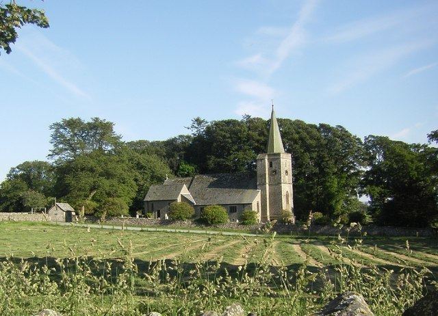
The Church of St Peter was built in 1878-79 and burnt down in 1913, but was accurately re-built in 1915.
Geology
Leck is located on two ancient geological fault lines: the Dent Fault and the Craven Fault. These meet at around 54.190507°N 2.527339°W / 54.190507; -2.527339. In the Carboniferous to Jurassic periods these major earth movements formed the dramatic landscape of Lonsdale and the Aire Gap in Craven District