
Designation Toronto Bike Trail 41 Length 3,000 m Uses Cycling, Walking | Season Year-round Province Ontario | |
 | ||
Location east of Leslie Street from Bond Park to just north of Eglinton Avenue East Trailheads To York Mills Road and 1 km south of Overland Drive | ||
522 leaside spur trail 6
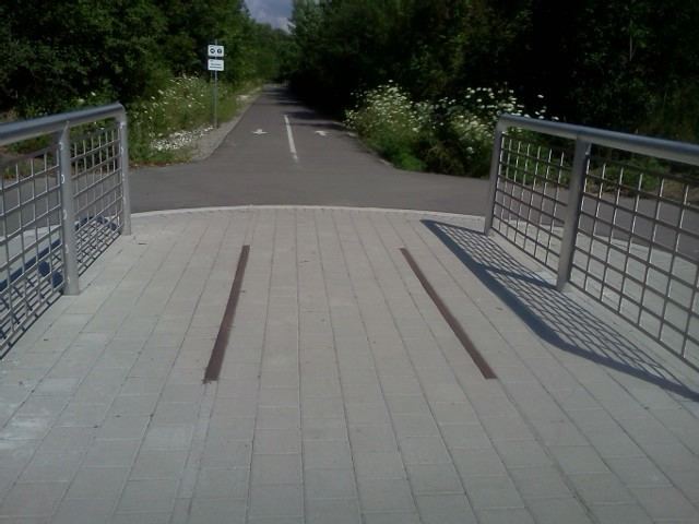
The Leaside Spur Trail is a 3 km cycling and walking trail in Toronto, Ontario, Canada. Acquired in 2003 from CN Rail by the City of Toronto, the trail is under construction with portions north of Lawrence Avenue completed.
Contents
- 522 leaside spur trail 6
- Map of Leaside Spur Trail Toronto ON Canada
- History
- Other Toronto railpaths
- References
Map of Leaside Spur Trail, Toronto, ON, Canada
A grade crossing at Lawrence Avenue was replaced with a signalized crossing.
Most of the trail runs between residential areas and southern portion through industrial and commercial properties. Both ends of the trail still meet with active rail lines (CN Bala Subdivision and CP Belleville Subdivision), but are now cut and blocked off.
Extensions north to York Mills Road and South to Leslie Street are planned, with the trail being declared pedestrian-only north of Bond Avenue (with signs along Bond and Scarsdale Road, already designated as Toronto Bike Trail 41A, for cyclists). The extension to York Mills Road was completed Tuesday August 2, 2016.
History
The trail was part of a spur line for CN Rail's Leaside corridor and has a 100-year-old overpass at Bond Park. The northern portions of the trail still have reminders of the trail's railway past.