
Canton Le Monêtier-les-Bains Population (2008) 1,057 Local time Tuesday 5:49 AM | Area 97.87 km² Arrondissement Briançon | |
 | ||
Weather 3°C, Wind NW at 5 km/h, 58% Humidity Points of interest Col du Galibier, ECOLE DE SKI SERRE C, Col du Lautaret, La Cucumelle, Musée d'Art Sacré | ||
Short clip le mon tier les bains centre with organ music from the church 1080p h d clip
Le Monêtier-les-Bains is a commune in the Hautes-Alpes department in southeastern France.
Contents
- Short clip le mon tier les bains centre with organ music from the church 1080p h d clip
- Map of Le MonC3AAtier les Bains France
- Geography
- Skiing
- Thermal baths
- Tour de France
- References
Map of Le Mon%C3%AAtier-les-Bains, France
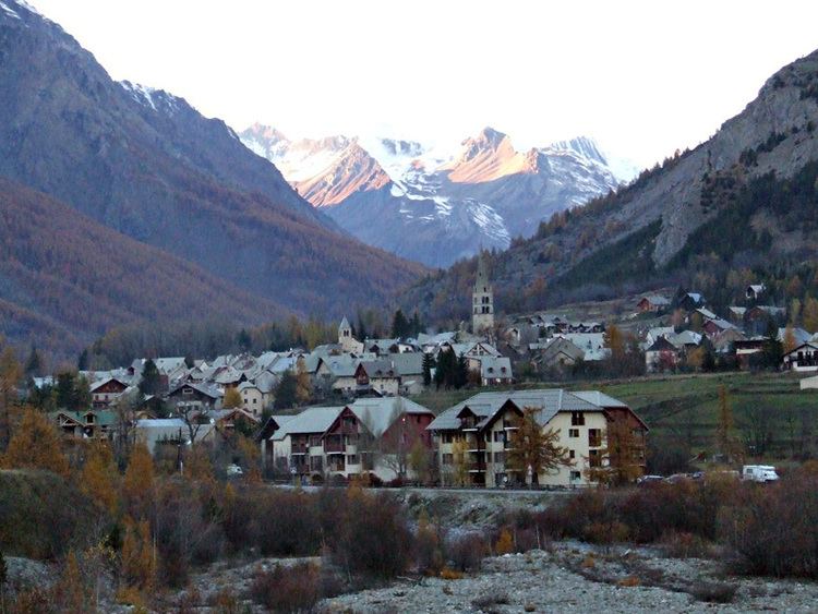
Geography
Le Monêtier-les-Bains is the highest village of the French ski resort of Serre Chevalier at 1,500m. It is situated in the Guisane Valley. Le Monêtier-Les-Bains has two hot-water springs, one at 34°C and one at 38°C, and the village has been a thermal spa since Roman times. The village is on the periphery of the Ecrins National Park.
Skiing
Monetier's slopes are a part of the extensive Serre Chevalier ski area. There are 7 chairlifts and 4 drag lifts with the highest skiing in the domain at 2760m.
Thermal baths
Warm water presence in the Monêtier area was already appreciated during the Roman Empire, when the village was known with the name of Stabatio (healing). Between 1715 and the late 19th century Monêtier was renowned for its thermal pools and facilities, which declined during the following century. From 1999 the new thermal bath of Les grands Bains was opened and, thanks to the following improvement works, Le Monêtier-les-Bains became, again, a popular destination for spa tourism.
Tour de France
The village lies on the Col du Lautaret and is regularly used in the Tour de France. It has featured recently in the tours of 1996, 1999, 2000, 2003, 2005, 2007 and 2008. In the 2011 Tour it was also passed through with about 20km to go on the 18th stage.