Intercommunality Louvigné Area 16.92 km² Population 585 (1999) | Canton Louvigné-du-Désert Time zone CET (UTC+1) Local time Tuesday 4:25 AM | |
 | ||
Weather 3°C, Wind W at 3 km/h, 100% Humidity Arrondissement Arrondissement of Fougères-Vitré | ||
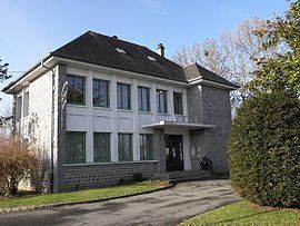
Le Ferré (Breton: Ferred) is a commune in the Ille-et-Vilaine department in Brittany in northwestern France.
Contents
Map of 35420 Le Ferr%C3%A9, France
Population
Inhabitants of Le Ferré are called Ferréens in French.
References
Le Ferré Wikipedia(Text) CC BY-SA
