
Intercommunality Pays du Roi Morvan Area 34.03 km² Population 2,840 (2011) | Canton Le Faouët Time zone CET (UTC+1) Elevation 152 m | |
 | ||
Le Faouët (Breton: Ar Faoued) is a commune in the Morbihan department of the region of Brittany in north-western France.
Contents
- Map of 56320 Le FaouC3ABt France
- Geography
- Administration
- Demographics
- Breton language
- Tourist attractions
- References
Map of 56320 Le Faou%C3%ABt, France
The Breton language name of the commune means Beech forest. The sixteenth century timber market halls are a noted feature of the town and two medieval chapels lies within the boundaries of the commune.
Geography
Le Faouët/Ar Faoued lies in the historical region of Cornouaille. Traditionally a Breton-speaking area, the French language became commonly used from the 1950s. The town lies in the valley of the river Ellé.
Administration
Le Faouët/Ar Faoued is the seat of the Canton du Faouët. The other communes making up the canton are Berné, Guiscriff, Lanvénégen, Meslan, and Priziac.
Demographics
The population at recent censuses was:
Inhabitants of Le Faouët are called Faouëtais.
Breton language
In 2008, 14,24% of the children attended the bilingual schools in primary education.
Tourist attractions
The sixteenth century halles, or covered market, remain in use and are a rare surviving example of a large timber structure from the period.
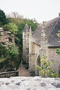
The chapel of Saint Barbara is sited on a hilltop overlooking the Ellé. The fifteenth century chapel of Saint Fiacre was recently restored. The polychrome timber interior was highly regarded, and earned its creator, Olivier Le Loergan, a title of nobility. The stained glass is also noteworthy. Parts of the interior have suffered considerable damage from insects.