
Population (1999) 2,984 Area 36 km² | Time zone CET (UTC+1) Local time Tuesday 3:22 AM | |
 | ||
Weather 7°C, Wind NE at 5 km/h, 64% Humidity Points of interest Lac du Lauvitel, Col du Lautaret, Musée Des Minéraux, Le Rochail | ||
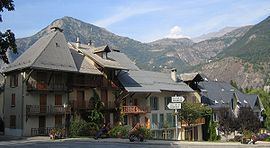
Le Bourg-d'Oisans is a commune in the Isère department in southeastern France.
Map of 38520 Le Bourg-d'Oisans, France
It is located in the Oisans region of the French Alps. Le Bourg-d'Oisans is located in the valley of the Romanche river, on the road from Grenoble to Briançon, and on the south side of the Col de la Croix de Fer. It is often on the route of the Tour de France, as the town sits at the base of the road to Alpe d'Huez and the legendary switchbacks to the top of the mountain (those wanting to test their skills against the professional cyclists' times can rent bicycles in Bourg d'Oisans and ride to the top where the tourist office offers a certificate of official completion that costs one Euro).
It is surrounded by several well-known mountain resorts, including the Alpe d'Huez and Les Deux Alpes. The Écrins National Park lies to the southeast of Le Bourg-d'Oisans.