
Native name Le Lay Length 120 km | Basin size 1,750 km (680 sq mi) Mouth elevation 0 | |
 | ||
Main source Saint-Pierre-du-Chemin195 m (640 ft) River mouth Bay of Biscay0 m (0 ft) Discharge Average rate:14 m/s (490 cu ft/s) Similar Yon, Marais Poitevin, Sèvre Nantaise, Puy du Fou, La Tour Moricq | ||
The Lay (French: le Lay) is a 120.3 km (74.8 mi) long river in the Vendée département, western France. Its source is at Saint-Pierre-du-Chemin. It flows generally southwest. It flows into the Bay of Biscay between La Faute-sur-Mer and L'Aiguillon-sur-Mer, 20 km (12 mi) northwest of La Rochelle.
Contents
Map of Le Lay, France
Its main tributaries are the Yon and the Smagne.
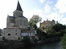
Communes along its courseEdit
This list is ordered from source to mouth:
References
Lay (river) Wikipedia(Text) CC BY-SA