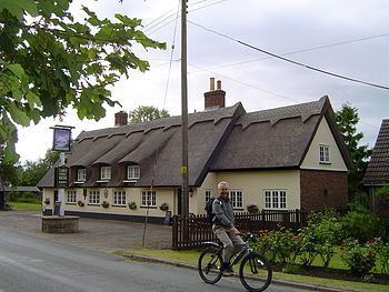
Sovereign state United Kingdom Postcode district IP29 District Babergh | ||
 | ||
Population 968 (Including Ickworth. 2011) | ||
Lawshall is a village and civil parish in Suffolk, England. Located around a mile off the A134 between Bury St Edmunds and Sudbury, it is part of Babergh district. The parish has nine settlements comprising the three main settlements of The Street, Lambs Lane and Bury Road along with the six small hamlets of Audley End, Hanningfield Green, Harrow Green, Hart's Green, Hibb's Green and Lawshall Green.
Contents
Map of Lawshall, Bury Saint Edmunds, UK
Notable buildings in the parish include All Saints Church and Lawshall Hall. In addition Coldham Hall is very close to the village and part of the grounds of the estate are located within the parish. Other important features include Frithy Wood, which is classified as Ancient Woodland and a designated Site of Special Scientific Interest (SSSI), and The Warbanks historical site.
Etymology
The village was originally known as "Hlaw-gesella" which meant the shelter or hut on a hill or high ground. Early records indicate that in later years the name was recorded as "Laushella" (972), "Lawesselam" (1086), "Laveshel" (1095), "Laweshell" (1194) and "Laugesale" (1253). Other names identified in the County of Suffolk records include Lausel, Lausele, Lausell, Lauselle, Laushalle, Laushill, Laushille, Laushull, Laushulle, Lausill, Lawcell, Laweshill, Laweshille, Lawishille, Lawsall, Lawschyll, Lawsele and Lawsell.
Background
The village of Lawshall is a dispersed in nature with an extremely scattered distribution of houses and groups of houses. There are three main centres of settlement within the parish, these being The Street (the area around the Church and Village School extending towards Swanfield), Lambs Lane (including The Glebe, Shepherds Drive and Windsor Drive) and the linear development along Bury Road. In addition there are six small hamlets comprising Audley End, Hanningfield Green, Harrow Green, Hart's Green, Hibb's Green and Lawshall Green.
The centre of the village is recognised as the area around All Saints Church and the Primary School.
Early records
The earliest documentary record for the village dates from approximately 972AD. However, it seems highly probable that there was a settlement within the parish well before this time. The present centre of the village is unlikely to have been the site of the original settlement as the basic requirement for a reliable supply of water would have precluded the area around the church. Hanningfield Green has been suggested as a stronger possibility for the site of the original Bronze Age settlement but another location could have been somewhere along the Chad Brook although none of the early records gives the exact location. Morley suggests that the original settlement place was beside the stream near Coldham Hall.
The earliest evidence of man in the parish can be identified in the now nearly ploughed out Warbanks which were certainly pre-Roman and may have been an earlier defence system. A late Bronze Age sword (now in the Moyse's Hall Museum in Bury St Edmunds) was found on the site of the Warbanks and has been dated as 800-600BC and could give a clue to the age of the bank.
Around 972 Alwinus, son of Bricius, was Lord of the Manor. Alwinus joined the monastery of Ramsey in Huntingdonshire and surrendered his manor to the Abbot. This was duly recorded in the Ramsey Chronicle and represents the first documentary evidence of Laushella (Lawshall). The land was to remain with the Ramsey Abbey until about 1534.
Medieval period
Lawshall was recorded in the Domesday Book (1086) and the entry for the parish states "St Benedict held Lawshall as a Manor with eight caracutes of land". The parish held the following:
