
Time zone EET (UTC+2) Area 176.9 km² | Elevation 1 m (3 ft) Postal code 195 xx | |
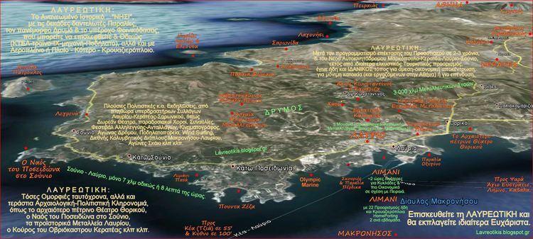 | ||
Lavreotiki is a municipality at the southeasternnmost tip of the Attica peninsula in the Greek regional unit of East Attica. Its municipal seat is the town of Laurium (Lavrio).
Contents
Map of Lavreotiki, Greece
It is historically important as a significant ancient mining district, most notably in the villages of Laurium and Thorikos on the southeastern seaboard during the 6th, 5th, and 4th centuries BCE. As such it financed the wealth of Athens and the emergence of the Athenian Empire through the slave-powered mining efforts for silver and lead, beginning with the discovery of 2 deep-vein mining efforts during the 480's. Prior to that development, which at Themistocles urging in 483 BC led to the expansion of the Athenian fleet to 200 ships, only surface-mining was deployed as a technique for harvesting silver. More than 250 ore washeries have been identified by archaeologists and geologists in the district.
Municipality
The municipality Lavreotiki was formed at the 2011 local government reform by the merger of the following 3 former municipalities, that became municipal units:
The municipality has an area of 175.798 km2, the municipal unit 35.484 km2.
Settlements
The main settlements within the municipal unit of Lavreotiki are (population at 2011 census):