
Population 85,716 (2009) | Time zone CST (UTC-6) | |
 | ||
Area 3,566 km² (3,548 km² Land / 18.13 km² Water) | ||
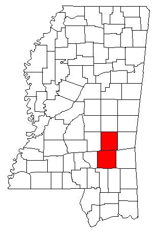
The Laurel Micropolitan Statistical Area is a micropolitan area in the southeastern Mississippi that covers two counties - Jasper and Jones. As of the 2000 census, the USA had a population of 83,107 (though July 1, 2009 estimate placed the population at 85,716).
Contents
Counties
Incorporated places
Unincorporated places
Demographics
As of the census of 2000, there were 83,107 people, 30,983 households, and 22,507 families residing within the USA. The racial makeup of the USA was 65.73% White, 32.13% African American, 0.32% Native American, 0.22% Asian, 0.01% Pacific Islander, 1.12% from other races, and 0.47% from two or more races. Hispanic or Latino of any race were 1.67% of the population.
The median income for a household in the USA was $26,614, and the median income for a family was $32,208. Males had a median income of $27,728 versus $18,333 for females. The per capita income for the USA was $13,855.