
Local time Monday 11:19 AM | ||
 | ||
Weather 6°C, Wind NE at 16 km/h, 52% Humidity | ||
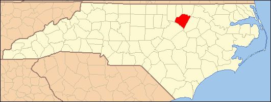
Laurel Mill, also known as just Laurel, is an unincorporated community in northeastern Franklin County, North Carolina, United States. It is located west of Centerville, at an elevation of 292 feet (89 m). The primary cross roads where the community is located are Laurel Mill-Centerville Road (SR 1436), Jones Chapel Road (SR 1432) and Laurel Mill Road (SR 1436).
Map of Laurel, Sandy Creek, NC 27549, USA
Laurel Mill and Col. Jordan Jones House and Speed Farm, located in Laurel Mill, are listed on the National Register of Historic Places.
References
Laurel Mill, North Carolina Wikipedia(Text) CC BY-SA