
Country United States Incorporated 1962 Area 78 ha Population 92 (2013) | Established 1882 Elevation 104 m Founded 1882 Local time Tuesday 12:39 PM | |
 | ||
Weather 21°C, Wind S at 23 km/h, 45% Humidity | ||
Centerville is a town in the rural northeastern corner of Franklin County, North Carolina, United States. The population was 89 at the 2010 census, a loss of 10 persons from the previous count of 99 at the 2000 census. There is no post office in Centerville, and thus no zip code; it simply uses that of Louisburg, which is located 12 miles (19 km) west. "Downtown" Centerville is centered on "the crossroads", which is the intersection of NC-561 and NC-58, and consists of two small old-fashioned country stores, one each on two of that intersection's four corners. Two sell gasoline (Arnold's and The Country Store), and one of those also sells diesel and kerosene (The Country Store). All two sell basic general store items, such as toilet paper, soap, household cleaning products, canned and boxed food, etc., as well as common convenience store items such as sodas, snack foods, cigarettes, beer, etc.
Contents
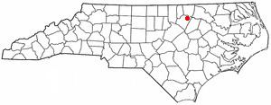
Map of Centerville, NC 27549, USA
There's also a Dollar General, a muffler shop and a medical clinic.
Centerville has its own church (Centerville Baptist Church, a member of the Southern Baptist Convention), and volunteer fire department. There is no police department, so Centerville—like the surrounding unincorporated area—is patrolled by the Franklin County sheriff.
As is common in the rural stretches of eastern North Carolina, many of the houses in and around Centerville are quite old and in poor states of repair, and agriculture is the main use of land. Tobacco, soybeans, corn, and hay are the main crops.
Centerville includes many antique buildings from its heyday, including the now-defunct Serepta Church, a former Methodist church located at the intersection of NC-561 and Centerville-Laurel Mill Road.
At 0.28-square-mile (0.73 km2), Centerville is among the smallest incorporated cities in North Carolina. Nearby cities and towns of larger size include Louisburg (12 miles west on NC-561, population 3,111), Warrenton (17.5 miles north on NC-58, population 811), and Castalia (10 miles south on NC-58, population 340).
Perry School and Vine Hill are listed on the National Register of Historic Places.
History
Centerville was established around 1882 and named for its central location between the towns of Louisburg, Warrenton and Littleton. It was incorporated during the same time period as the dissolution of the nearby town of Wood in 1961, roughly 80 years after first settlement.
Geography
Centerville is located at 36°11′6″N 78°6′41″W (36.184980, −78.111252).
According to the United States Census Bureau, the city has a total area of 0.3 square miles (0.78 km2), all of it land.
Demographics
As of the census of 2010, there were 89 people residing in the city. The racial makeup of the city was 93% White (83 persons), 3.5% Black (3 persons), and 3.5% other (3 persons).
Government
Unlike elected officials of other Franklin County municipalities (as well as the county itself) which have four-year terms, the mayor and three-member Town Council for Centerville are elected every two years.