
Country Thailand Khwaeng 6 Postal code 10520 Area 123.9 km² Province Bangkok | Seat Lat Krabang Time zone ICT (UTC+7) Geocode 1011 Population 171,933 (2016) | |
 | ||
Top10 recommended hotels in lat krabang thailand
Lat Krabang (Thai: ลาดกระบัง; [lâːt krā.bāŋ]) is one of the eastern 50 districts of Bangkok.
Contents
- Top10 recommended hotels in lat krabang thailand
- Map of Lat Krabang Bangkok Thailand
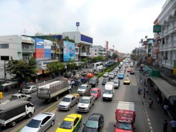
- Streetlife in lat krabang thailand
- Administration
- Places
- References
Map of Lat Krabang, Bangkok, Thailand
Neighboring districts are (from the south clockwise) Bang Bo, Bang Sao Thong and Bang Phli (Samut Prakan Province), Prawet, Saphan Sung, Min Buri and Nong Chok (Bangkok) and Mueang Chachoengsao (Chachoengsao Province).
In October 2005, the plan to create the special administrative area Nakhon Suvarnabhumi around Suvarnabhumi Airport became public. Lat Krabang was among the five districts that were to be included in this new administrative area.
Streetlife in lat krabang thailand
Administration
The district is divided into six sub-districts (Kwaeng).
Places
References
Lat Krabang District Wikipedia(Text) CC BY-SA