Settled 1910 Time zone EST (UTC−5) Population 1,277 (2011) | Constituted March 21, 1922 Area 89.6 km² Province Québec | |
 | ||
Region | ||
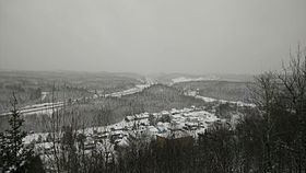
Larouche is a municipality in Quebec, Canada, part of Le Fjord-du-Saguenay Regional County Municipality. It is located along Quebec Route 170 between Jonquière and Saint-Bruno, just south of the Saguenay River.
Contents
Map of Larouche, QC, Canada
History
In the early 1910s, several families settled in the area. In 1911, the settlement got its post office and in 1922, the Parish Municipality of Larouche was incorporated, named after William Larouche (1835-1917), a pioneer who was among the area's first settlers.
In 2000, the parish municipality changed its status to municipality.
Demographics
Population trend:
Private dwellings occupied by usual residents: 510 (total dwellings: 641)
Mother tongue:
References
Larouche, Quebec Wikipedia(Text) CC BY-SA
