
Area rank 76 of 105 Lowest elevation 266 m (873 ft) Area 15.4 km² Lau 2 12006 | Canton Mersch Highest elevation 420 m (1,380 ft) Time zone CET (UTC+1) Local time Sunday 11:19 PM | |
 | ||
Weather 5°C, Wind NE at 13 km/h, 69% Humidity | ||
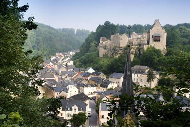
Larochette (Luxembourgish: Fiels, German: Fels) is a commune and town in central Luxembourg, in the canton of Mersch. It is situated on the White Ernz river. The town is dominated by the partly ruined Larochette Castle.
Contents
Map of Larochette, Luxembourg
As of 2005, the town of Larochette, which lies in the north-east of the commune, has a population of 1,359. Other towns within the commune include Ernzen.
Meysembourg Castle, located some 2 kilometres (1 1⁄4 mi) south-west of Larochette, has a history dating back to the 12th century. Today's castle was built in 1880 in Neo-Renaissance style and is privately owned.
Birkelt campsite larochette luxembourg eurocamp co uk
References
Larochette Wikipedia(Text) CC BY-SA