
Country United States Time zone CST (UTC-6) Elevation 152 m Local time Sunday 5:05 PM | Established November 5, 1861 ZIP codes 62426, 62838, 62858 Area 96.4 km² Population 644 (2010) | |
 | ||
Weather 4°C, Wind E at 8 km/h, 33% Humidity | ||
Larkinsburg Township is one of twelve townships in Clay County, Illinois, USA. As of the 2010 census, its population was 644 and it contained 296 housing units.
Contents
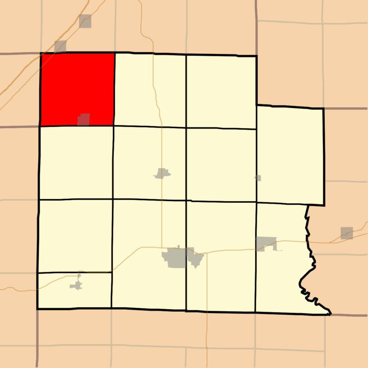
- Map of Larkinsburg Township IL USA
- Geography
- Cities towns villages
- Cemeteries
- Major highways
- Lakes
- School districts
- Political districts
- References
Map of Larkinsburg Township, IL, USA
Geography
According to the 2010 census, the township (T5N R5E) has a total area of 37.22 square miles (96.4 km2), of which 37.12 square miles (96.1 km2) (or 99.73%) is land and 0.1 square miles (0.26 km2) (or 0.27%) is water.
Cities, towns, villages
Cemeteries
The township contains these eight cemeteries: Burge, Fender, Iola, Keen Chapel, Littleton, Price, Rodgers and Woods.
Major highways
Lakes
School districts
Political districts
References
Larkinsburg Township, Clay County, Illinois Wikipedia(Text) CC BY-SA