
Capital Lares UBIGEO 080404 Area 527.3 km² | Region Cusco Time zone PET (UTC-5) Elevation 3,150 m | |
 | ||
The lares adventure to machu picchu my life changing experience
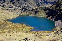
Lares District is one of eight districts of the province Calca in Peru.
Contents
- The lares adventure to machu picchu my life changing experience
- Map of Lares Peru
- Geography
- Ethnic groups
- References
Map of Lares, Peru
Geography
The Urupampa mountain range traverses the district. One of the highest peaks of the district is Sawasiray at 5,818 m (19,088 ft). Other mountains are listed below:
Ethnic groups
The people in the district are mainly indigenous citizens of Quechua descent. Quechua is the language which the majority of the population (94.91%) learnt to speak in childhood, 4.77% of the residents started speaking using the Spanish language (2007 Peru Census).
References
Lares District Wikipedia(Text) CC BY-SA