
Population 266 (2011 census) Postal code 4285 | Postcode(s) 4285 | |
 | ||
Laravale is a locality in the Scenic Rim Region of South East Queensland, Australia. At the 2011 Australian Census Laravale and the neighbouring locality of Tamrookum recorded a combined population total of 266.
Map of Laravale QLD 4285, Australia
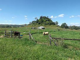
Part of the southern border is marked by the Widgee Creek, the Logan River and the Mount Lindesay Highway. The Sydney–Brisbane rail corridor also passes through the locality. In the east the northern extent of the Jinbroken Range elevates the terrain to heights greater than 350 m above sea level. Agriculture, including dairying, has developed in the more fertile areas adjacent to the Logan River.
Laravale State School opened in 1900 and closed in 2010. The Beaudesert Shire Tramway had a stop at Laravale. It was once part of Beaudesert Shire.