
Population 266 (2011) Postal code 4285 | Postcode(s) 4285 | |
 | ||
Tamrookum is a small rural locality in the Scenic Rim Region, Queensland, Australia. In the 2011 census, Tamrookum and surrounds had a population of 266 people.
Contents
Map of Tamrookum QLD 4285, Australia
Geography
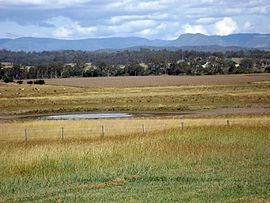
The Mount Lindesay Highway traverses Tamrookum from north to south and forms part of the north west boundary. The eastern boundary is marked by the Logan River. A series of small, vegetated hills in the west rises to elevations of up to 140 m. In the east adjacent to the river the predominate land use is agriculture.
History
The name Tamrookum is believed to be a corruption of the Aboriginal words dhan/buragun meaning place of boomerangs.
Heritage listings
Tamrookum has a number of heritage-listed sites, including:
References
Tamrookum, Queensland Wikipedia(Text) CC BY-SA