
Population 0 (2011 census) Postcode(s) 4110 Postal code 4110 | Established 1970 Founded 1970 | |
 | ||
State electorate(s) Electoral district of Algester | ||
Larapinta is a suburb located in the southern regions of Brisbane, on the boundary with Logan City. The suburb has no residents, being mostly bushland, save for the recent industrial development. The industrial area has become a new addition to the expansion of Brisbane's industry, including the purpose built South Brisbane Industrial Park in nearby Heathwood.
Map of Larapinta QLD 4110, Australia
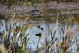
Larapinta means "flowing water" and was so named because the north and west of the suburb is bounded by Oxley Creek. Sand mining has occurred in the area, resulting in a change of course for the main stream of the creek.
The Sydney–Brisbane rail corridor passes along the eastern border of the suburb. The Logan Motorway bisects the suburb in an east/west direction. In the south the Glider Forest Conservation Area has been created to protect a large tract of bushland.