
Elevation −5 m (−16 ft) Postcode 2650–2665 Area 56 km² | Established 1 January 2007 Time zone CET (UTC+1) Website www.lansingerland.nl Local time Sunday 5:43 PM Area code 010 | |
 | ||
Weather 9°C, Wind E at 14 km/h, 68% Humidity Points of interest Rotte, De Melkschuur, Speeltuinvereniging De Kievit, Hoge Bergse Bos, Bleiswijkse Verlaat | ||
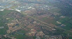
Lansingerland in zicht november 2016
Lansingerland is the name for the new municipality in the western Netherlands, in the province of South Holland. It was formed on 1 January 2007, by the merger of the municipalities of Berkel en Rodenrijs, Bleiswijk and Bergschenhoek, collectively known as the "B-Triangle". The former municipality of Tempel, abolished in 1855, is also part of Lansingerland.
Contents
- Lansingerland in zicht november 2016
- Map of Lansingerland Netherlands
- Autodieven s nachts buurttoezicht lansingerland
- Politics
- References
Map of Lansingerland, Netherlands
The name was chosen from a competition and derived from the name Lansingh, the height-of-land between the Delfland and Schieland Water Boards, which runs between the "B-Triangle" villages. The choice of name is symbolic: the name of the border that formerly divided the area, now unites it. The "h" in Lansingh was dropped to ease spelling.
Lansingerland consists of the following communities:
Autodieven s nachts buurttoezicht lansingerland
Dutch Topographic map of the municipality of Lansingerland, June 2015
Politics
On 18 September 2007 Ewald van Vliet was installed as the first mayor of Lansingerland.
The municipal council of Lansingerland consists of 31 seats. They were last contested in March 2014 and the results were as follows: