
Time zone CET/CEST (UTC+1/+2) Area 36.37 km² Population 3,903 (31 Dec 2008) Dialling code 03761 | Elevation 280 m (920 ft) Postal codes 08428 Local time Sunday 1:15 PM Postal code 08428 | |
 | ||
Weather 8°C, Wind E at 11 km/h, 48% Humidity | ||
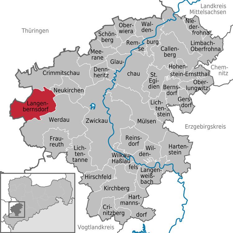
Langenbernsdorf is a village in the district of Zwickau in the Free State of Saxony.
Contents
- Map of Langenbernsdorf Germany
- Geography
- Neighboring municipalities
- Municipality subdivisions
- History
- References
Map of Langenbernsdorf, Germany
Geography
To the north of Langenbernsdorf is a wood called the Werdauer Wald.
Neighboring municipalities
Adjacent municipalities in the district of Zwickau include:
Teichwolframsdorf in Thuringia is also adjacent to Langenbernsdorf.
Municipality subdivisions
The municipality includes the following subdivisions:
History
Langenbernsdorf was founded in 1257 and was named "Bernztorff".
References
Langenbernsdorf Wikipedia(Text) CC BY-SA