
Time zone CET/CEST (UTC+1/+2) Population 12,636 (31 Dec 2008) | Elevation 204 m (669 ft) Postal codes 38685 Local time Sunday 1:11 PM | |
 | ||
Weather 9°C, Wind E at 16 km/h, 57% Humidity Points of interest | ||
Langelsheim is a town in the district of Goslar, in Lower Saxony, Germany.
Contents
- Map of 38685 Langelsheim Germany
- Geography
- City subdivisions
- History
- Town council
- International relations
- Notable people
- References
Map of 38685 Langelsheim, Germany
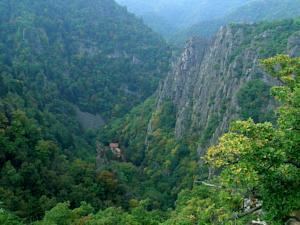
Geography
The municipality is situated between the river Innerste and its tributary Grane, on the northern edge of the Harz mountain range and the Harz National Park, located about 8 km (5.0 mi) northwest of Goslar.
City subdivisions
History
The place once called Langenizze developed in the 10th century out of a hill fort at the Kahnstein mountain, erected by the Ottonian dynasty. Langelsheim was the site of historic ironworks, first documented in the 13th century, where ore from the Mines of Rammelsberg was smelted.
Town council
2006 local elections:
International relations
Langelsheim is twinned with:
Notable people
References
Langelsheim Wikipedia(Text) CC BY-SA