
Country United States County Franklin FIPS code 20-38400 Elevation 271 m Zip code 66042 Local time Sunday 6:10 AM | Time zone Central (CST) (UTC-6) GNIS feature ID 0477598 Area 62 ha Population 224 (2013) Area code 785 | |
 | ||
Weather -6°C, Wind S at 2 km/h, 100% Humidity | ||
Lane is a city in Franklin County, Kansas, United States. As of the 2010 census, the city population was 225.
Contents
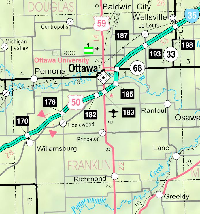
Map of Lane, KS 66042, USA
History
Lane was originally called Shermanville, and under the latter name laid out in 1855. It was renamed Lane in 1863 for James H. Lane, a leader of the Jayhawkers abolitionist movement, who served as one of the first Senators from Kansas.
Lane is the site where in 1856, John Brown (abolitionist) and 4 other of his followers hacked 3 pro-slavery men to death with broadswords near Pottawatomie Creek. The event is commonly referred to as the Pottawatomie massacre.
Lane was a station on the Missouri Pacific Railroad.
Geography
Lane is located at 38°26′25″N 95°4′56″W (38.440265, -95.082339). According to the United States Census Bureau, the city has a total area of 0.24 square miles (0.62 km2), all of it land.
Climate
The climate in this area is characterized by hot, humid summers and generally mild to cool winters. According to the Köppen Climate Classification system, Lane has a humid subtropical climate, abbreviated "Cfa" on climate maps.
2010 census
As of the census of 2010, there were 225 people, 102 households, and 61 families residing in the city. The population density was 937.5 inhabitants per square mile (362.0/km2). There were 112 housing units at an average density of 466.7 per square mile (180.2/km2). The racial makeup of the city was 98.2% White, 0.9% Asian, 0.4% from other races, and 0.4% from two or more races. Hispanic or Latino of any race were 1.8% of the population.
There were 102 households of which 23.5% had children under the age of 18 living with them, 47.1% were married couples living together, 9.8% had a female householder with no husband present, 2.9% had a male householder with no wife present, and 40.2% were non-families. 27.5% of all households were made up of individuals and 5.9% had someone living alone who was 65 years of age or older. The average household size was 2.21 and the average family size was 2.72.
The median age in the city was 45.1 years. 21.8% of residents were under the age of 18; 8.5% were between the ages of 18 and 24; 19.5% were from 25 to 44; 35.1% were from 45 to 64; and 15.1% were 65 years of age or older. The gender makeup of the city was 52.0% male and 48.0% female.
2000 census
As of the census of 2000, there were 97 households, and 71 families residing in the city. The population density was 1,177.8 people per square mile (449.3/km²). There were 105 housing units at an average density of 483.1 per square mile (184.3/km²). The racial makeup of the city was 96.48% White, 0.39% Black or African American, 0.39% Native American, 0.39% Asian, and 2.34% from two or more races. Hispanic or Latino of any race were 0.39% of the population.
There were 97 households out of which 33.0% had children under the age of 18 living with them, 57.7% were married couples living together, 11.3% had a female householder with no husband present, and 25.8% were non-families. 22.7% of all households were made up of individuals and 7.2% have someone living alone who was 65 years of age or older. The average household size was 2.64 and the average family size was 2.99.
In the city, the population was spread out with 26.2% under the age of 18, 10.5% from 18 to 24, 30.5% from 25 to 44, 20.3% from 45 to 64, and 12.5% who were 65 years of age or older. The median age was 35 years. For every 100 females there were 103.2 males. For every 100 females age 18 and over, there were 110.0 males.
The median income for a household was $41,500, and the median income for a family was $42,500. Males had a median income of $32,031 versus $21,429 for females. The per capita income for the city was $19,144. About 11.4% of families and 12.0% of the population were below the poverty line, including 13.1% of those under the age of 18 and none of those 65 and older.
Education
Lane is a part of Central Heights USD 288 located in Richmond. School mascot is Central Heights Vikings.
Lane schools were closed through school unification in 1965. The Lane High School mascot was Lane Lions.