
Country United States FIPS code 27-35378 Elevation 277 m Zip code 56735 Local time Saturday 11:57 PM | Time zone Central (CST) (UTC-6) GNIS feature ID 0646463 Area 5.96 km² Population 335 (2013) Area code 218 | |
 | ||
Weather -15°C, Wind N at 8 km/h, 77% Humidity | ||
How to say or pronounce usa cities lancaster minnesota
Lancaster is a city in Kittson County, Minnesota, United States. As of the 2010 census, the city population was 340.
Contents
- How to say or pronounce usa cities lancaster minnesota
- Map of Lancaster MN 56735 USA
- History
- Geography
- 2010 census
- 2000 census
- References
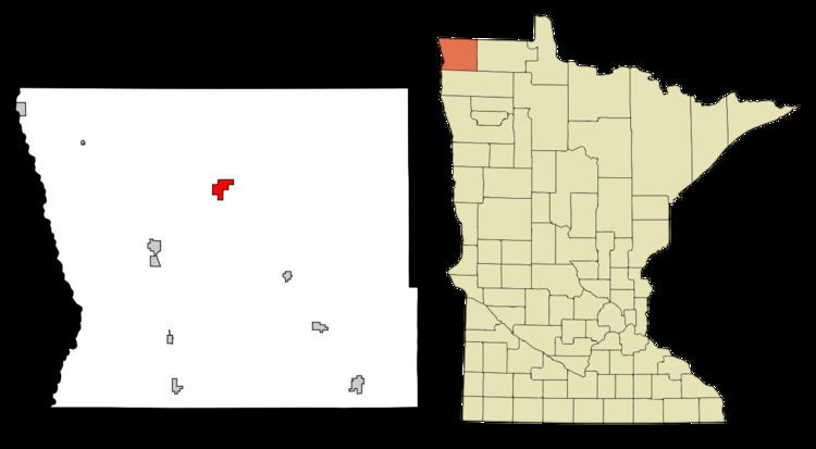
Map of Lancaster, MN 56735, USA
History
Lancaster was incorporated in 1904 along a Soo Line Railroad line running from Glenwood to the Canada–US border. The city was named after a railroad official believed to have come from Lancashire County in England.
Geography
According to the United States Census Bureau, the city has a total area of 2.30 square miles (5.96 km2), all of it land.
Lancaster is located along U.S. Highway 59, at the junction with Kittson County Roads 4, 5, and 6. The North Branch Two Rivers flows nearby. The Canadian border is located nine miles north of the city.
2010 census
As of the census of 2010, there were 340 people, 163 households, and 98 families residing in the city. The population density was 147.8 inhabitants per square mile (57.1/km2). There were 189 housing units at an average density of 82.2 per square mile (31.7/km2). The racial makeup of the city was 98.8% White, 0.6% Asian, and 0.6% from other races. Hispanic or Latino of any race were 1.5% of the population.
There were 163 households of which 20.9% had children under the age of 18 living with them, 53.4% were married couples living together, 5.5% had a female householder with no husband present, 1.2% had a male householder with no wife present, and 39.9% were non-families. 37.4% of all households were made up of individuals and 22.7% had someone living alone who was 65 years of age or older. The average household size was 2.09 and the average family size was 2.74.
The median age in the city was 47.6 years. 20.3% of residents were under the age of 18; 8.9% were between the ages of 18 and 24; 16.7% were from 25 to 44; 30.9% were from 45 to 64; and 23.2% were 65 years of age or older. The gender makeup of the city was 47.1% male and 52.9% female.
2000 census
As of the census of 2000, there were 363 people, 154 households, and 91 families residing in the city. The population density was 161.6 people per square mile (62.3/km²). There were 193 housing units at an average density of 85.9 per square mile (33.1/km²). The racial makeup of the city was 98.90% White, 0.28% Native American, 0.28% Asian, and 0.55% from two or more races. Hispanic or Latino of any race were 1.10% of the population.
There were 154 households out of which 31.8% had children under the age of 18 living with them, 48.7% were married couples living together, 6.5% had a female householder with no husband present, and 40.9% were non-families. 39.0% of all households were made up of individuals and 22.7% had someone living alone who was 65 years of age or older. The average household size was 2.36 and the average family size was 3.19.
In the city, the population was spread out with 29.5% under the age of 18, 7.7% from 18 to 24, 25.1% from 25 to 44, 19.6% from 45 to 64, and 18.2% who were 65 years of age or older. The median age was 38 years. For every 100 females there were 107.4 males. For every 100 females age 18 and over, there were 95.4 males.
The median income for a household in the city was $33,750, and the median income for a family was $47,083. Males had a median income of $31,346 versus $27,000 for females. The per capita income for the city was $16,191. About 9.2% of families and 9.7% of the population were below the poverty line, including 11.1% of those under age 18 and 10.8% of those age 65 or over.