
Country Thailand Postal code 31130 Area 802.9 km² | Time zone ICT (UTC+7) Geocode 3110 Province Buriram Province | |
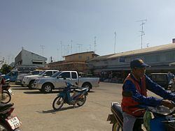 | ||
Lam Plai Mat (Thai: ลำปลายมาศ, [lām plāːj mâːt]) is a district (amphoe) of Buriram Province, northeastern Thailand.
Contents
Map of Lam Plai Mat District, Buriram, Thailand
Geography
Neighboring districts are (from the northeast clockwise) Khu Mueang, Mueang Buriram, Chamni, Nong Hong of Buriram Province, Huai Thalaeng, Chum Phuang, and Lam Thamenchai of Nakhon Ratchasima Province.
Administration
The district is divided into 16 sub-districts (tambon), which are further subdivided into 220 villages (muban). There are two townships (thesaban tambon): Lam Plai Mat covers parts of the tambon Lam Plai Mat, Nong Khu and Hin Khon; Thamenchai covers parts of tambon Thamenchai and Nong Bua Khok. There are a further 15 tambon administrative organizations (TAO).
References
Lam Plai Mat District Wikipedia(Text) CC BY-SA