
Country Russia Local time Saturday 11:43 PM | Federal subject Republic of Karelia | |
 | ||
Administrative district Lakhdenpokhsky District Administrative center of Lakhdenpokhsky District Municipal district Lakhdenpokhsky Municipal District Urban settlement Lakhdenpokhskoye Urban Settlement Weather -2°C, Wind W at 11 km/h, 79% Humidity | ||
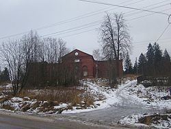
Lakhdenpokhya (Russian: Лахденпо́хья; Finnish: Lahdenpohja) is a town and the administrative center of Lakhdenpokhsky District of the Republic of Karelia, Russia, located 330 kilometers (210 mi) west of Petrozavodsk on the Aurayoki River. Population: 7,813 (2010 Census); 8,751 (2002 Census); 10,429 (1989 Census).
Contents
- Map of Lakhdenpokhya Republic of Karelia Russia
- History
- Administrative and municipal status
- Transportation
- References
Map of Lakhdenpokhya, Republic of Karelia, Russia
History
Town status was granted to it in 1945.
Administrative and municipal status
Within the framework of administrative divisions, Lakhdenpokhya serves as the administrative center of Lakhdenpokhsky District, to which it is directly subordinated. As a municipal division, the town of Lakhdenpokhya, together with the station of Yakkima, is incorporated within Lakhdenpokhsky Municipal District as Lakhdenpokhskoye Urban Settlement.
Transportation
The town serves as a railway station on the Vyborg–Joensuu railway.