
Area 71.33 km² | Phone +1 573-348-2694 | |
 | ||
Address 403 Hwy. 134, Kaiser, MO 65047, United States Hours Open today · 10AM–6PMSaturday10AM–6PMSunday10AM–6PMMonday10AM–6PMTuesday10AM–6PMWednesday10AM–6PMThursday10AM–6PMFriday10AM–6PM Similar Pomme de Terre State Park, Mark Twain State Park, Grand Glaize Bridge, Bridal Cave, Crowder State Park | ||
A look at lake of the ozarks state parks
Lake of the Ozarks State Park is a Missouri state park on the Grand Glaize Arm of the Lake of the Ozarks and is the largest state park in the state. Originally owned by the United States National Park Service as part of the Recreational Demonstration Areas when the lake was built in the 1930s, it was donated to the state after World War II.
Contents
- A look at lake of the ozarks state parks
- Lake of the ozarks state park
- National Register of Historic PlacesEdit
- References
The park includes 85 miles (137 km) of shoreline on the lake (which has a total of 1,150 miles (1,850 km) of shoreline—mostly privately owned); two swimming beaches with imported sand, 12 trails, the Ozark Caverns, a boat launch, and the Lee C. Fine Memorial Airport which has a 6,500-foot (2,000 m) runway. In addition there are campsites and cabins within the park.
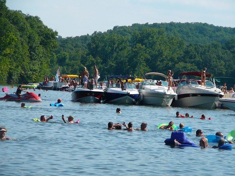
One of the most famous aspects of the park is Party Cove which is a rowdy gathering spot that has been featured on the Playboy Channel and the front page of the New York Times Travel Section.
Lake of the ozarks state park
National Register of Historic PlacesEdit
The following buildings and national historic districts were individually listed on the National Register of Historic Places in 1985. They are also included in the Emergency Conservation Work (E.C.W.) Architecture in Missouri State Parks, 1933-1942, Thematic Resources.