
Type landslide formation Area 100 ha | Primary inflows Surface area 1 km (0.39 sq mi) | |
 | ||
Primary outflows Nothing visible but has a gurgler | ||
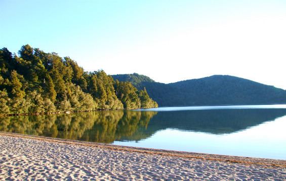
Beautiful lake rotopounamu
Lake Rotopounamu is a secluded lake in the Pihanga Scenic Reserve, in the Tongariro National Park in New Zealand's Central North Island. It lies at the northwest foot of Mt Pihanga, and was formed by a landslide around 10,000 years ago. The lake is fed by seven streams, but has no visible surface outflow. It is believed to drain underground.
Contents
- Beautiful lake rotopounamu
- Map of Lake Rotopounamu Tongariro National Park 3382 New Zealand
- Lake rotopounamu outflow underground
- Recreation
- References
Map of Lake Rotopounamu, Tongariro National Park 3382, New Zealand
Lake rotopounamu outflow underground
Recreation
Around the lake is a scenic 5-kilometre (3 mi) loop track, which can be accessed from the Pihanga Saddle road (State Highway 47) between Turangi and Tongariro. Walking this track takes about two hours.
References
Lake Rotopounamu Wikipedia(Text) CC BY-SA