
Type Volcanic lake Surface area 552 ha (1,360 acres) Max. depth 60 m (200 ft) Area 5.52 km² | Average depth 45 m (148 ft) Surface elevation 80 m Mean depth 45 m | |
 | ||
Similar Lake Bullen Merri, Mount Leura, Mount Porndon, Lake Wendouree, Mount Elephant | ||
Underwater gopro on downrigger lake purrumbete victoria 12 january 2014
Lake Purrumbete is a volcanic lake located in the Western District of Victoria, Australia. Lake Purrumbete is approximately 15 kilometres (9.3 mi) east of the town of Camperdown. The lake is in a shallow volcanic crater. The water is crystal clear most times of the year as the lake relies totally on its own catchment.
Contents
- Underwater gopro on downrigger lake purrumbete victoria 12 january 2014
- Map of Lake Purrumbete Koallah VIC 3260 Australia
- Lake purrumbete july 2013
- Recreational activities
- References
Map of Lake Purrumbete, Koallah VIC 3260, Australia
Lake purrumbete july 2013
Recreational activities
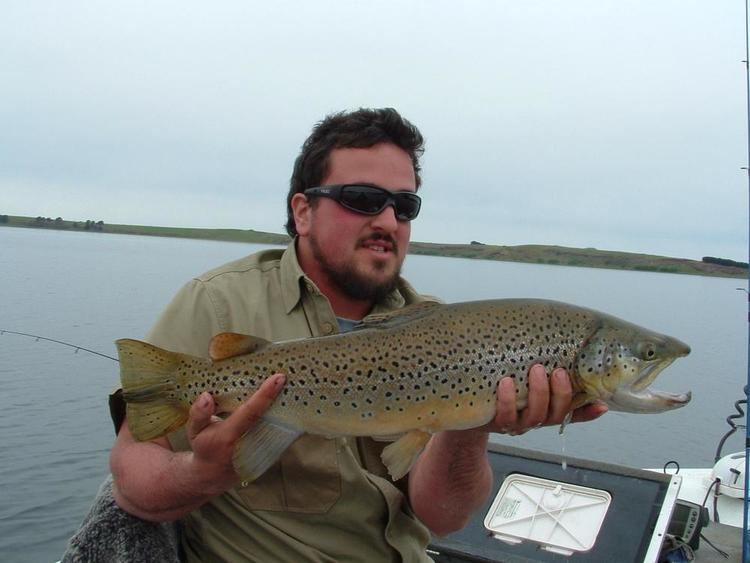
Lake Purrumbete is a prime destination for anglers chasing chinook salmon and rainbow and brown trout. The banks are heavily weeded at places, but the depth drops sharply once away from the bank, it can get more than 60 metres (200 ft) deep. There are heavy-duty boat ramps and jetties at the caravan park.
The Lake Purrumbete Caravan Park has cabins, ice, public toilets, mooring facilities, jetties, fish cleaning facilities, day parking and a dual lane concrete boat ramp. The park is on the foreshore at the lake’s southern end.