
Official name Lake Mutirikwi Construction began 1958-1960 Catchment area 3900 km² Area 90 km² Inflow source Mutirikwe River | Impounds Mutirikwi River Length 309 m Height 63 m Impound Mutirikwi river | |
 | ||
Total capacity 1,378 million cubic metres | ||
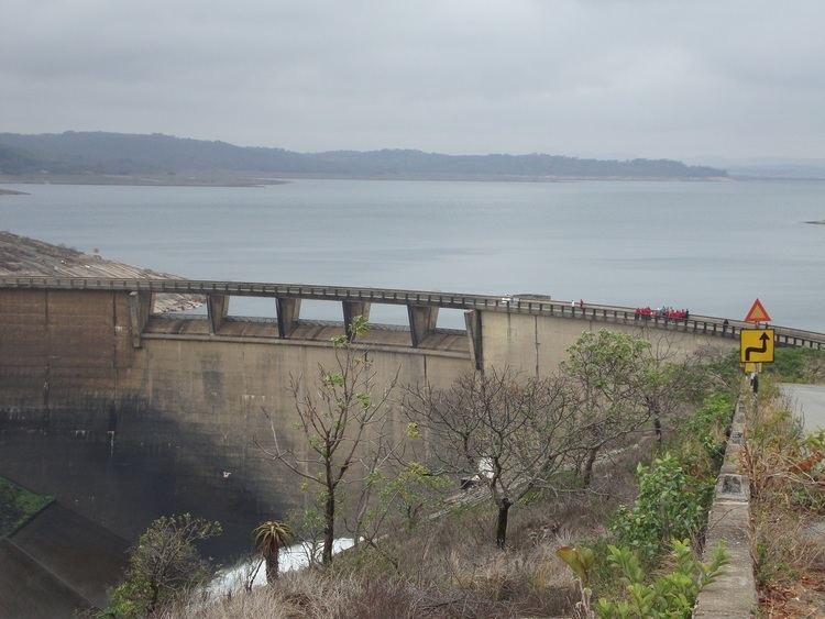
Lake Mutirikwi, formerly known as Lake Kyle, lies in south eastern Zimbabwe, south east of Masvingo. It is thought to have been named Lake Kyle, from the Kyle farm which occupied most of the land required for the lake, which in turn was named after the Kyle district in Scotland from which pioneer of the Lowveld Tom Murray MacDougall came originally. It covers about 90 km² and was created in 1960 with the construction of the Kyle Dam on the Mutirikwi River. The dam was built to provide irrigation water to the farming estates on the lowveld to the southwest, around the town of Triangle, where the main crop has been sugar cane.
Map of Lake Mutirikwi, Zimbabwe
Lake Kyle Recreational Park lies on the reservoir's northern shore, while there is a small recreational park on the southern shore. Great Zimbabwe national monument lies close by.
Rivers which feed the lake include the Mbebvi River, Matare River, Pokoteke River, Umpopinyani River, Makurumidze River and Mushagashe River.
In the 1980s, drought drastically lowered the water level in the lake, but during the 1990s it recovered. The level fluctuates widely due to irrigation demands and the seasonal rainfall.