
Basin countries Italy Max. width 1.545 km (0.960 mi) Max. depth 60 m (200 ft) Surface elevation 305 m | Max. length 2.015 km (1.252 mi) Surface area 2.44 km (0.94 sq mi) Area 244 ha Shore length 6 km | |
 | ||
Location Province of Rome, Lazio | ||
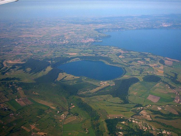
Lake Martignano (Italian: Lago di Martignano), is a small lake in Lazio, Italy 24 kilometres (15 mi) north-north-west of Rome, in an extinct crater or maar. Administratively its coast is divided amongst the municipalities of Rome, Anguillara Sabazia and Campagnano di Roma.
Contents
Map of Lake Martignano, Rome, Italy
OverviewEdit
In ancient times Lake Martignano was part of southern Etruria and called Alsietinus Lacus. Augustus drew from it the Aqua Alsietina; the water was hardly fit to drink, and was mainly intended to supply his naumachia (lake made for a sham naval battle) at Rome, near San Francesco a Ripa, on the right bank of the Tiber, where some traces of the aqueduct were perhaps found in 1720. The course of the aqueduct, which was mainly subterranean, is practically unknown: Frontinus tells us that it received a branch from the lake of Bracciano near Careiae (Galera): and an inscription relating to it was found in this district in 1887.
There is a lawn beach, lake-side cafes and restaurants, and walking tracks.