
Primary inflows Basin countries United States Max. depth 40 ft (12 m) Surface elevation 175 m | Primary outflows Guadalupe River Surface area 410 acres (170 ha) Area 166 ha Outflow location Guadalupe River | |
 | ||
Similar Lake McQueeney, Lake Placid, Comal Springs, Gruene Hall, Schlitterbahn New Braunfels | ||
Lake Dunlap is a reservoir on the Guadalupe River near the town of New Braunfels in Guadalupe County, Texas, United States. The reservoir was formed in 1931 by the construction of a dam to provide hydroelectric power to the area. Management of the dam and lake was assumed by the Guadalupe-Blanco River Authority on May 1, 1963. Lake Dunlap also serves as a venue for outdoor recreation, including fishing and boating.
Contents
Map of Lake Dunlap, Texas 78130, USA
Fish and plant life
Lake Dunlap has been stocked with species of fish intended to improve the utility of the reservoir for recreational fishing. Fish present in Lake Dunlap include catfish, crappie, striped bass, and largemouth bass.
Recreational uses
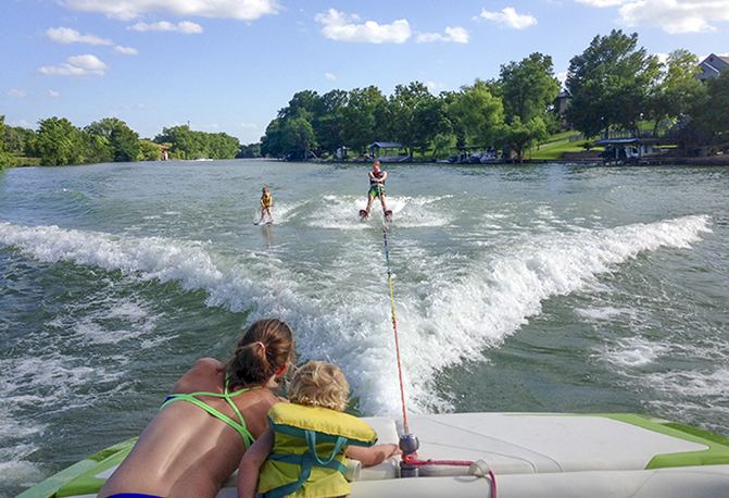
The only free public access to the lake is a boat ramp located at the overpass of Interstate Highway 35 in New Braunfels. Lake Dunlap proudly offers mostly calm water due to its narrow size (in parts) and being protected of wind by shoreline trees. Wakeboarders, skiers and other recreational enthusiasts use Lake Dunlap daily due to its family friendly calmness, temperature and status of near-private lake. Boaters should use extreme caution as the lake has numerous unmarked stumps.