
Opening date 1992 (1992) Surface elevation 96 m Mean depth 13 m | Status Operational Area 3.39 km² Catchment area 3.4 km² Operator Seqwater | |
 | ||
The Lake Clarendon Dam is a rock and earth-fill embankment dam with an un-gated spillway located off-stream in the South East region of Queensland, Australia. The main purpose of the dam is for irrigation of the Lockyer Valley. The resultant impounded reservoir is called Lake Clarendon.
Contents
Map of Lake Clarendon, QLD 4343, Australia
Location and features
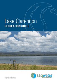
Located 10 kilometres (6.2 mi) northeast of Gatton, the Lake Clarendon Dam is part of a number of small dams built above the Lockyer Valley to supply water for irrigation purposes.
The 4,300 m (14,100 ft) long rock and earthfill structure has a maximum height of 13.1 m (43 ft) and an overflow spillway which diverts excess water into a series of open channels that eventually flow into the Lockyer Creek. The dam creates a reservoir, Lake Clarendon, with a storage capacity of 24,330 megalitres (5.35×10⁹ imp gal; 6.43×10⁹ US gal) and a maximum surface area of 339 hectares (840 acres). The dam is managed by SEQ Water.
Completed in 1992, by mid-2006 the dam was empty due to drought conditions in Australia. In January 2011, the dam was over 80% full according to the Queensland Water Commission website.
Recreation
A Stocked Impoundment Permit is no longer required to fish in the reservoir. Lake Clarendon was removed from the SIP scheme in 2012.