
Max. width 20 km (12 mi) Length 45 km Width 20 km | Max. length 45 km (28 mi) Area 650 km² Surface elevation 1,123 m | |
 | ||
Surface area 650.00 km (250.97 sq mi) | ||
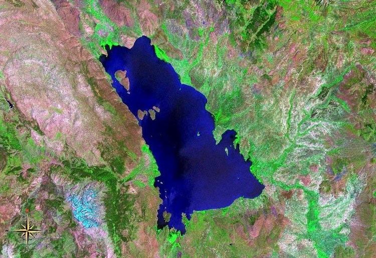
Lake Beyşehir (Turkish: Beyşehir Gölü) is a large freshwater lake in Konya provinces, southwestern part of Turkey. It is located at around 37°47′0″N 31°33′0″E and is the largest freshwater lake in Turkey. It has an area of 650.00 km² and is 45 km long and 20 km wide. It carries the same name as the principal urban centre of its region, Beyşehir.
Map of Lake Bey%C5%9Fehir, Turkey
The lake is fed by streams flowing from the Sultan Mountains and the Anamas Mountains. The water level in the lake often fluctuates by year and by season. Lake Beyşehir is used for irrigation and aquaculture, although it is also a national park. There are thirty-two islets in varying sizes in the lake. Lake Beyşehir is also an important site for many bird species.
The maximum depth is 10 metres.
Water in the lake was at its lowest level during the period 1960-1990 in October 1975 at 1121.96 metres, with 64,500 hectares of water surface. The highest water level in the same period was 1125.50 metres in March 1981, with a surface area of 74,600 hectares.