
Area 47.9 km² | Established November 27, 1936 Phone +52 777 372 2524 | |
 | ||
Governing body Secretariat of the Environment and Natural Resources Similar Desierto de los Leones National, Cumbres del Ajusco National, El Tepozteco, La Marquesa National, Ajusco | ||
Lagunas de zempoala mexico
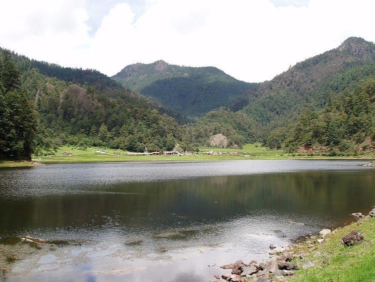
Lagunas de Zempoala National Park is a natural protected area which consists of a group of seven lagoons. In the Nahuatl language, "Zempoala" means "place of many waters." The park is located between the states of Morelos and State of Mexico, Mexico.
Contents
Geography
The lagoons of Zempoala are located in a biological corridor named Chichinautzin, between the municipalities of Ocuilan de Arteaga, at the southwestern section of State of Mexico and Huitzilac, northwestern section of the state of Morelos, 50 km away from Mexico City.
The National Park covers about 4,700 hectares (12,000 acres) and lies at an elevation of about 2,900 meters (9,500 feet) above sea level.
The Park
The Park consists of seven lagoons: Zempoala, Compila, Tonatihua, Seca, Ocoyotongo, Quila, and Hueyapan which are supplied with water through rain and the rivers descending from the Ajusco and the surrounding mountains. Three of the lagoons (Zempoala, Tonatihua, and Prieta) have water the whole year, and the other four are seasonal.
Flora and fauna
The abundant forests surrounding the park include different types of trees such as oaks, cedars, pine trees and firs. In the park there is a possibility of finding a great variety of mammals such as deer, foxes, weasels, rabbits, squirrels, skunks, birds (such as falcons, hummingbirds and sparrows), and amphibians such as the Axolotl.
Decree
The Zempoala lagoons were granted the title of national park on November 27, 1936 by the president of Mexico, and the decree was modified in May 1947 to reduce the parks territory to its current 4,700 hectares.