
 | ||
Similar Punta Ballena, Casapueblo, Lussich Arboretum, Playa Mansa, Playa Brava | ||
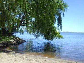
Laguna del sauce farms hotel punta del este uruguay
Laguna del Sauce (Lagoon of the Willow) is the largest water body in the Maldonado Department of Uruguay. It is located 15 kilometres (9.3 mi) west of Punta del Este.
Contents
- Laguna del sauce farms hotel punta del este uruguay
- Map of Laguna del Sauce Maldonado Department Uruguay
- Laguna del sauce uruguay
- Geography
- Sports
- Surroundings
- References
Map of Laguna del Sauce, Maldonado Department, Uruguay
Laguna del sauce uruguay
Geography
The lagoon covers 50 square kilometres (19 sq mi) and is 12 kilometres (7.5 mi) long and 6 kilometres (3.7 mi) wide. The stream Arroyo Pan de Azucar discharges into the southwest of the lagoon, while the streams Arroyo del Sauce and Arroyo Mallorquina discharge in its north and northwest. A stream called Arroyo Potrero at the south end of the lagoon empties the water into the Río de la Plata at of the beach of Chihuahua.
Sports
Any kind of non-motor powered water sports are allowed in the lagoon, such as wind surfing.
Surroundings
The Capitan Corbeta CA Curbelo International Airport is in the southwest coast of the lagoon, just east of the lake resort La Capuera. To the southeast is the "Club del Lago Golf" course, to the south of which is the Arboretum Lussich. In the east coast of the lagoon (from south to north) is the park "Parque Jacarandá", the location and resort "Las Cumbres", the hills Sierra de la Ballena, Cerro Caballero, Cerro de la Cruz and the location "Abra del Pedromo", with a statue of San Francisco on the hill Cerro de Francés. On the west coast of the lagoon are the hills Cerro Sanguinetti and Cerro Las Mojinetes.