
 | ||
Similar Centro Visite Gradina, Timavo, Rocca di Monfalcone, Rilke trail, Monte Ermada | ||
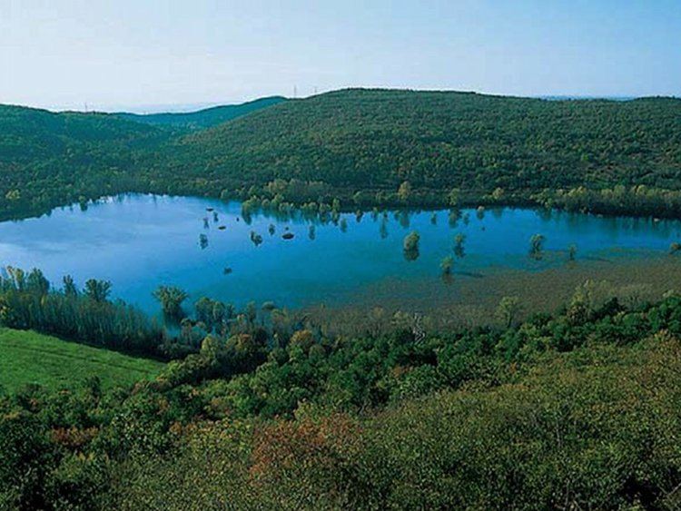
Il carso lago di doberd fenomeni carsici il lago che appare e scompare
Lake Doberdò (Italian: Lago di Doberdò, Slovene: Doberdobsko jezero) is the name of a sinkhole in the Province of Gorizia, Friuli-Venezia Giulia, Italy. It is located on the westernmost edge of the Karst (Italian: Carso) plateau, close to the border with Slovenia. It is named after the village of Doberdò (Slovene: Doberdob).
Contents
- Il carso lago di doberd fenomeni carsici il lago che appare e scompare
- Map of Lago di DoberdC3B2 34070 DoberdC3B2 del Lago Province of Gorizia Italy
- Lago di doberd un video da ascoltare
- OverviewEdit
- References
Map of Lago di Doberd%C3%B2, 34070 Doberd%C3%B2 del Lago, Province of Gorizia, Italy
Lago di doberd un video da ascoltare
OverviewEdit
It has an area of approximately 0.36 km², depending on the time of year, and it is located around 2 km southwest of the village of Doberdò, not far from the Adriatic coast. The water is filtered through various ponors, and it is connected with the springs feeding the Timavo River, which are located a few kilometers southeast. The depth varies from 5 to 10 m. The lake is usually largest in autumn, when it is 1.2 km long and 350 m wide. During the frequent drought periods, the lake almost completely disappears, becoming a marsh-like area.