
Primary inflows Length 165 m | Primary outflows none Max. length 180 m (590 ft) Width 73 m | |
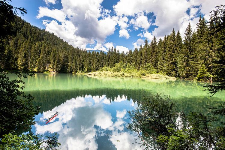 | ||
Lag Tuleritg is a lake at Flims in the canton of Grisons, Switzerland.
Map of Lag Tuleritg, 7018 Flims, Switzerland
As close as 500 metres to the Caumasee, well known for swimming, is another dell, home of Lag Tuleritg which is just 18 metres higher. This lake falls completely dry in autumn and remains empty until being filled by a small river of just about half a mile in length (falling some 100 metres in level) that will start flowing around May depending on temperatures and snow melt rate in the mountains. Its origin is another lake, Lag Prau Pulté, which is fed by underground water only in spring, disapperaring in autumn and staying dry all winter. During a cold period in spring, water that entered the dell of this lake may disappear again as snow melt decreases and all water remains in the underground flow. Due to its origin the water of both lakes is grey all summer until the level starts to go down in autumn. In Lag Prau Pulte one can see another special effect caused by air being forced out of the underground, causing the lake not only to remain grey but offernig frequent bubbles on the surface.
Because its proximity it is very likely that the water from Lag Tuleritg continues underground to Caumasee, although no experiments using colour was ever to prove this.