
Named for Marquis de Lafayette Area 1,412 km² Area code 870 | Founded 15 October 1827 Population 7,252 (2013) | |
 | ||
ZIP code(s) 71826, 71827, 71845, 71860, 71861 Website www.lafayettecounty.arkansas.gov Cities | ||
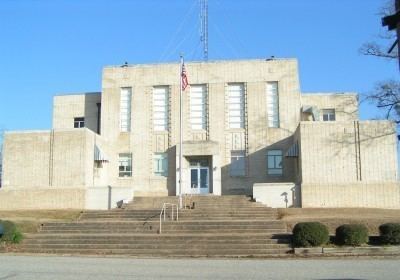
Lafayette County /lɑːfeɪɛt/ is a county located in the U.S. state of Arkansas. As of the 2010 census, the population was 7,645, making it the third-least populous county in Arkansas. The county seat is Lewisville. Lafayette County was formed on October 15, 1827 and named in honor of Marquis de Lafayette, a French military hero of the American Revolutionary War. It is a dry county; therefore, the sale of alcohol is prohibited.
Contents
- Map of Lafayette County AR USA
- Geography
- Major highways
- Adjacent counties
- Demographics
- Towns
- Townships
- References
Map of Lafayette County, AR, USA
Geography
According to the U.S. Census Bureau, the county has a total area of 545 square miles (1,410 km2), of which 528 square miles (1,370 km2) is land and 17 square miles (44 km2) (3.1%) is water. It is the smallest county in Arkansas by area.
Major highways
Adjacent counties
Demographics
As of the 2000 United States Census, there were 8,559 people, 3,434 households, and 2,376 families residing in the county. The population density was 16 people per square mile (6/km²). There were 4,560 housing units at an average density of 9 per square mile (3/km²). The racial makeup of the county was 62.08% White, 36.49% Black or African American, 0.37% Native American, 0.22% Asian, 0.01% Pacific Islander, 0.20% from other races, and 0.63% from two or more races. 1.03% of the population were Hispanic or Latino of any race.
There were 3,434 households out of which 27.90% had children under the age of 18 living with them, 50.60% were married couples living together, 14.40% had a female householder with no husband present, and 30.80% were non-families. 28.40% of all households were made up of individuals and 14.60% had someone living alone who was 65 years of age or older. The average household size was 2.46 and the average family size was 3.00.
In the county, the population was spread out with 25.40% under the age of 18, 8.10% from 18 to 24, 24.40% from 25 to 44, 24.40% from 45 to 64, and 17.70% who were 65 years of age or older. The median age was 39 years. For every 100 females there were 93.60 males. For every 100 females age 18 and over, there were 87.80 males.
The median income for a household in the county was $24,831, and the median income for a family was $30,720. Males had a median income of $26,492 versus $17,000 for females. The per capita income for the county was $14,128. About 18.70% of families and 23.20% of the population were below the poverty line, including 31.50% of those under age 18 and 19.30% of those age 65 or over.
Towns
Townships
Townships in Arkansas are the divisions of a county. Each township includes unincorporated areas; some may have incorporated cities or towns within part of their boundaries. Arkansas townships have limited purposes in modern times. However, the United States Census does list Arkansas population based on townships (sometimes referred to as "county subdivisions" or "minor civil divisions"). Townships are also of value for historical purposes in terms of genealogical research. Each town or city is within one or more townships in an Arkansas county based on census maps and publications. The townships of Lafayette County are listed below; listed in parentheses are the cities, towns, and/or census-designated places that are fully or partially inside the township.
Source: