
Country Azerbaijan Telephone code (+994) 26 Founded 1930 | Postal code 4100 Area 1,835 km² Capital Lachin | |
 | ||
Lachin is a district in the Republic of Azerbaijan. Its administrative center is Lachin city. This territory was established in 1930 and given the status of a district. It was occupied on 18 May 1992 by the Republic of Armenia.
Contents
Map of Kashatagh Region, Azerbaijan
History
It was originally known as Abdalyar or Abdallyar (after the Turkic Abdal tribe). It was granted town status in 1923 and renamed Lachin (a Turkic first name meaning falcon) in 1926.
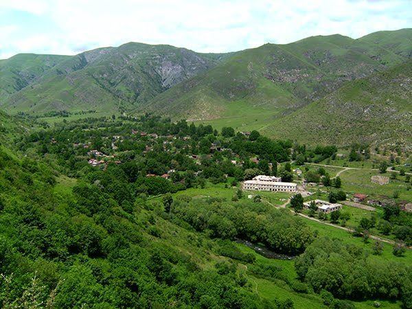
The district has one city, one settlement (Gayghi settlement) and 125 villages. It is located in the south west of Azerbaijan and is predominantly mountainous. The district shares borders with Kalbajar district in the north, Khojali, Shusha and Khojavand districts in the east, Gubadli district in the south and Armenia in the west.
Lachin district is an administrative rayon in the Republic of Azerbaijan. Established in 1930. Situated in the Lesser Caucasus, in the south-west of Azerbaijan. Bordered by Armenia on the west. It occupies an area of 1,835 square kilometres (708 sq mi), while the population is 68,900 (as of 01.01.2006). The capital is the city of Lachin.
The area is mountainous. Lachin extends to the south-western slope of Karabakh ridge on the east, to the south-eastern slope of Mikhtokan ridge on the north, to Karabakh plateau on the south-west. The highest point is the Qızılboga mountain (3594 m). Jurassic-anthropogenic sediments are spread. The rayon has mineral resources such as mercury, polymetals, building materials, Narzan-type mineral water springs. Mild warm and cold climate with dry winter prevails over the most of the area. The average temperature is from −10–0 °C (14–32 °F) in January, to 10–22 °C (50–72 °F) in July. Annual precipitation is 600–900 millimetres (24–35 in). The rayon`s river is Hakari and its tributaries. The most spread soil types are sod mountainous-meadow, brown mountainous-forest and carbonate mountainous-black. The vegetation comprises bushy and rare woods, deciduous mountain forests (oak, hornbeam, beech), sub-alpine and alpine meadows.
Lachin is an agricultural region. Cattle-breeding occupies has a major place in its economy.
There are 149 secondary schools, 2 pre-school and 5 extracurricular educational institutions, a vocational school, a children creativity center, 85 clubs, 119 libraries, 5 music schools, and 142 health facilities in the rayon.
The cave-temple (5th century), mausoleums (14th-19th century), a castle (17th century), a mosque (1718), a palace (1716), a bridge (18th century) are registered architectural monuments in the territory of Lachin.
Lachin was occupied on May 18, 1992, by the Armenian armed forces.
Between 1923 to 1929, Lachin was established as the Kurdistan Uyezd, an autonomous Soviet district.