
Listing Ultra First ascent 26 October 1987 Mountain range Labuche Himal | Elevation 7,367 m Prominence 1,957 m | |
 | ||
Easiest route West Ridge: glacier/snow climb First ascenders H. Furukawa, K. Sudo, Diaqiog, Gyala, Lhaji, Wanjia, A. Deuchi Similar Kangpenqing, Karjiang, Changtse, Molamenqing, Tongshanjiabu | ||
Labuche kang iii timelapse
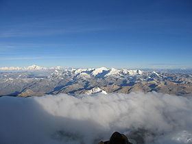
Labuche Kang (or Lapche Kang, Lobuche Kang I, Choksiam) is a northern outlier of the Himalayas inside Tibet. It rises northwest of Rolwaling Himal and east of Shishapangma. The peak belongs to a little-known section of the Himalaya variously called Labuche Himal, Pamari Himal and Lapchi Kang. that extends from the valley of the Tamakosi River west to the valley of the Sun Kosi and Nyalam Tong La pass where Arniko-Friendship Highway cross the Himalaya. This section extends south into Nepal east of Arniko Highway. It is wholly within the catchment of the Kosi, a Ganges tributary.
Contents
Map of Lapche Kang I, Tingri, Xigaze, China
Labuche Kang was first climbed in 1987 by a Sino-Japanese expedition, via the West Ridge. No other attempts are recorded until September 2010 when American climber Joe Puryear fell to his death during an unsuccessful attempt.
Labuche Kang III East
Another peak on the Labuche Kang massif, Labuche Kang III East 28°18′01″N 86°23′03″E (7,250 m Ranked 94th by elevation; Prom. = 570 m), is likely the second highest unclimbed peak in the world behind Gangkhar Puensum (7,570 m Ranked 40th; Prom. = 2,995 m), using a 500-meter prominence cutoff. The former second highest unclimbed mountain, Saser Kangri II East (7,513 m Ranked 49th; Prom. = 1,450 m), was first climbed on August 24, 2011.