
Time zone CET (UTC+1) Area 26 km² Local time Friday 11:35 AM Postal code 18414 | Judicial district Órgiva Elevation 1.3 m Population 663 (2014) | |
 | ||
Demonym(s) Bárbaro, -raPitreño, -ñaTalabita Weather 18°C, Wind SE at 6 km/h, 30% Humidity | ||
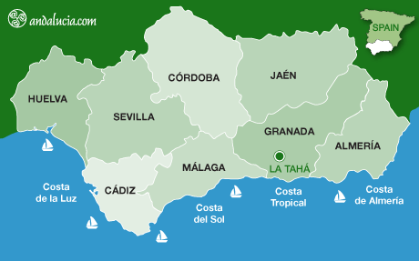
La Taha, is a municipality in the Alpujarras region of the province of Granada, Spain. The modern municipality consists of three distinct villages, though several of the villages are themselves clusters of distinct settlements. It lies to the east of the villages of the Río Poqueira gorge, and to the south and west of Trevélez. The villages are all on south-facing slopes overlooking the Río Trevélez.
Map of La Taha, Granada, Spain
The villages of La Taha are:
In guidebooks and other sources, some other neighbouring villages are often included in La Taha, though they do not belong to the municipality. These include Pórtugos and Busquístar.
The name La Taha comes from Arabic Tá meaning obedience. Under the Nasrid kings of Granada, the region was divided into a number of administrative districts called "tahas", each containing several settlements; for examples the villages of the Poquiera gorge formed "La Taha de Poqueira". Modern La Taha is the only one of these districts to have retained the name.
There is a modest tourist trade in La Taha, though the villages do not attract the intense interest either of the Poqueira river villages or of Trevélez. Pitres has a market on Friday. The GR 7 long-distance footpath passes through the municipality.
Atalbeitar is one of the best villages to learn about the original characteristics of the houses and streets of the Alpujarras, due to the lack of new buildings that other villages more touristics have been constructing.