Time zone EST (UTC-5) Elevation 35 m Local time Friday 5:21 AM | Area code(s) +53-41 Area 1,035 km² Population 16,937 (2004) | |
 | ||
Weather 19°C, Wind N at 8 km/h, 87% Humidity | ||
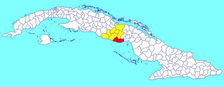
La Sierpe is a municipality and town in the Sancti Spíritus Province of Cuba. It is located in the south-eastern part of the province, 30 kilometres (19 mi) from Sancti Spiritus, the provincial capital.
Contents
Map of La Sierpe, Cuba
Geography
It borders the Gulf of Ana Maria of the Caribbean Sea to the south and the province of Ciego de Ávila to the east.
Demographics
In 2004, the municipality of La Sierpe had a population of 16,937. With a total area of 1,035 km2 (400 sq mi), it has a population density of 16.4/km2 (42/sq mi).
References
La Sierpe, Cuba Wikipedia(Text) CC BY-SA
