
Topo map USGS Fall River Pass | Elevation 3,104 m | |
 | ||
Similar Rocky Mountains, Rocky Mountain National, Grand River Ditch, Never Summer Mountains, Milner Pass | ||
La Poudre Pass elevation 10,184 ft (3,104 m) is a high mountain pass located in the Rocky Mountains of northern Colorado in the United States.
Map of La Poudre Pass, Colorado 80512, USA
The pass straddles the Continental Divide, and separates the headwaters of La Poudre Pass Creek, which drains into the Mississippi River and eventually the Atlantic Ocean, from the headwaters of the Colorado River, which drains into the Sea of Cortez. At the pass, the Continental Divide is the boundary between Grand and Larimer counties, and is also the northern boundary of Rocky Mountain National Park.
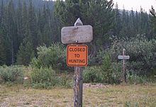
The pass itself is a broad, flat, swampy area. In the wet meadow just south of the divide, the Colorado River begins its course as a tiny stream. Rocky Mountain National Park's La Poudre Pass Ranger Station is also located in the pass.
The pass is traversed by a hiking trail, by the Grand Ditch as it carries water from the Never Summer Mountains into the Cache La Poudre River, and by a private, gated, maintenance road for the Grand Ditch.
To visit the pass, follow Long Draw Road south from its junction with State Highway 14 in Poudre Canyon, just east of Cameron Pass. Long Draw Road is unpaved, but can be traveled by regular passenger automobiles. After passing Long Draw Reservoir the road ends at the La Poudre Pass Trailhead parking area. It's a very short walk from here to the pass, which is marked by the entrance sign to Rocky Mountain National Park. At this sign, you are standing on the Continental Divide.