
Barangays ZIP code 2826 Local time Friday 3:42 PM | Time zone PST (UTC+8) Area 51.41 km² | |
 | ||
Weather 31°C, Wind NW at 8 km/h, 58% Humidity | ||
La Paz, officially the Municipality of La Paz (Ilocano: Ili ti La Paz, Filipino: Bayan ng La Paz), is a municipality in the province of Abra in the Cordillera Administrative Region (CAR) of the Philippines. The population was 15,437 at the 2015 census. In the 2016 electoral roll, it had 9,018 registered voters.
Contents
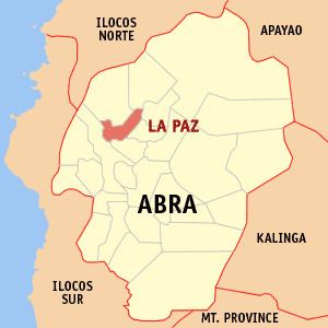
Map of La Paz, Abra, Philippines
Geography
La Paz is located at 17°41′N 120°41′E.
According to the Philippine Statistics Authority, the municipality has a land area of 51.41 square kilometres (19.85 sq mi) constituting 7000123000000000000♠1.23% of the 4,165.25-square-kilometre- (1,608.21 sq mi) total area of Abra.
Barangays
La Paz is politically subdivided into 12 barangays.
Demographics
In the 2015 census, La Paz had a population of 15,437. The population density was 300 inhabitants per square kilometre (780/sq mi).
In the 2016 electoral roll, it had 9,018 registered voters.