
 | ||
Asi es un dia de siembra en la mixteca oaxaca
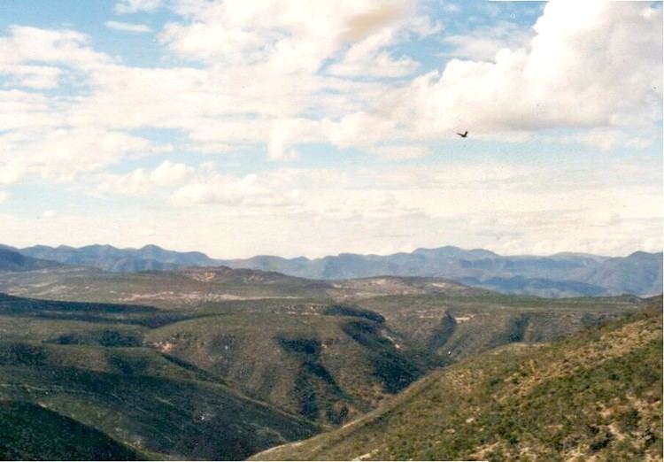
La Mixteca is a region in Western Oaxaca and neighboring portions of Puebla, Guerrero in south-central Mexico which refers to the home of the Mixtec people. The region covers some 40,000 km² where two of the country's mountain ranges, the Neo-Volcanic Belt and Sierra Madre del Sur, converge.
Contents
Geography
La Mixteca is a country of great contrasts. The Sierra Madre del Sur and the Neo-Volcanic Belt mark its northern limits. To the east, it is defined by the Cuicatlán Ravine and the Central Valleys of Oaxaca. To the west, the Mixteca region is adjacent to the valleys of Morelos and the central portion of Guerrero. To the south lies the Pacific Ocean. Because of the presence of the major mountains of the Sierra Mixteca, communications with the rest of the country are difficult.
The region is conventionally divided into three separate areas, defined by the prevailing height of the terrain.